
 |
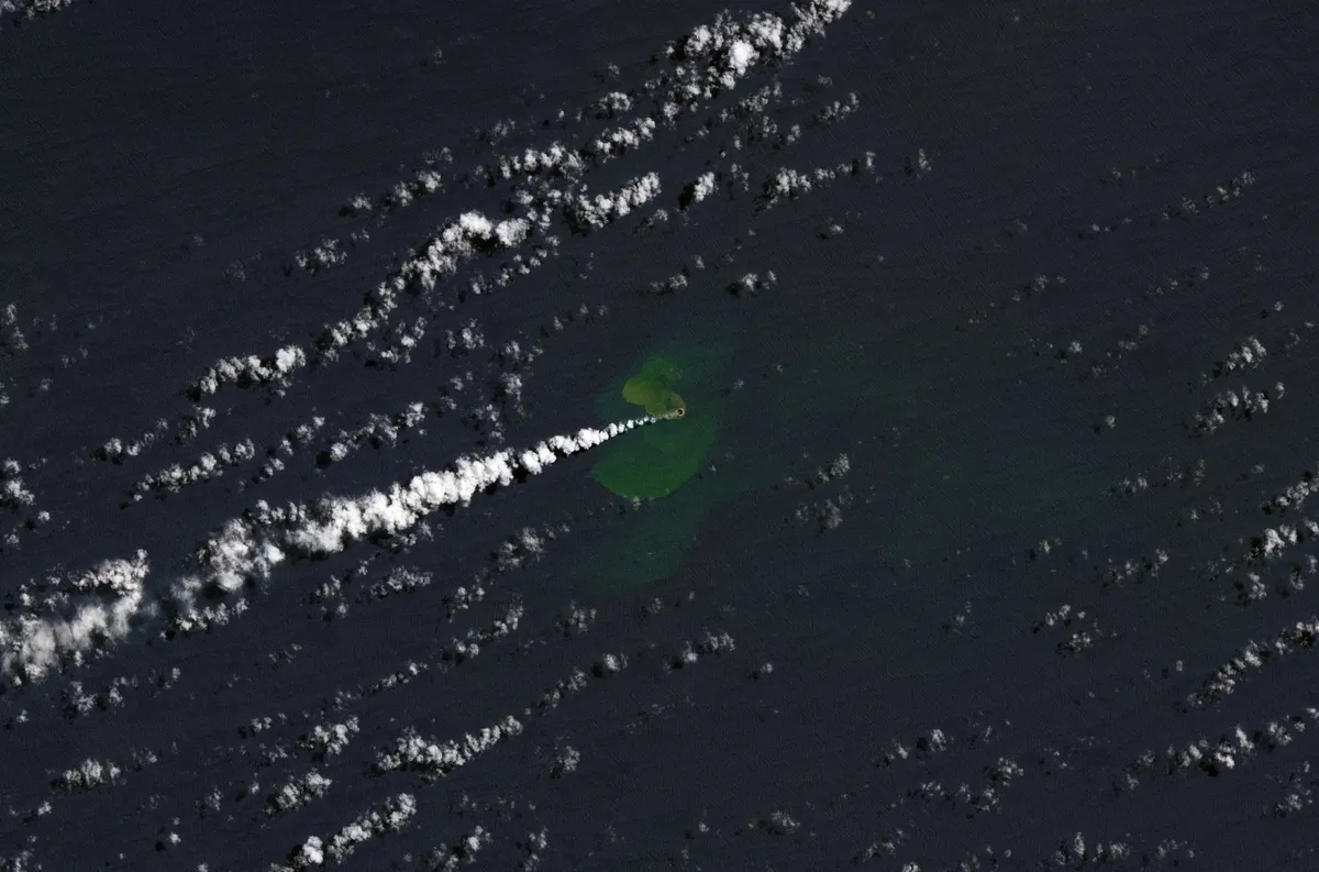
| An image taken by the Landsat 9 satellite on Sept. 14, 2022, showing a volcanic eruption creating a small island at Home Reef in Tonga. (Image credit: Lauren Dauphin, using Landsat data from the U.S. Geological Survey) |
The Hunga Tonga-Hunga Ha'apai underwater volcano in Tonga erupted with explosive fury on December 21, 2021, sending a shockwave around the planet numerous times. Another eruption is presently taking place in the Pacific nation, which consists of over 170 islands, although the situation is much calmer. The underwater Home Reef seamount has risen above the ocean's surface as a result of a small eruption that began on September 10, and the infant island that it formed has been captured by the powerful Landsat 9 satellite, a joint project between NASA and the United States Geological Survey (USGS) that was launched into Earth orbit last year.
Only 11 hours after the eruption began, the volcano rose from the water, with lava and ash forming a tiny island. Four days later, the land area of the little island was around 1 acre (0.4 hectares) (0.4 hectares). It had grown to 6 acres by September 20. (2.4 hectares).
Landsat 9 took the image on September 14, when the island was 1 acre in size. The image depicts discolored water that has been stirred by the eruption, as well as a big white plume. According to NASA, "Previous research suggests that these plumes of superheated, acidic seawater contain particulate matter, volcanic rock fragments and sulfur,"
In comparison to last year's Hunga Tonga-Hunga Ha'apai eruption, this year's eruption is quite small. The Tongan government now advises seafarers to keep at least 2.5 miles (4 kilometers) away and notes that the steam and ash plumes offer little risk to airplanes.


0 Comments