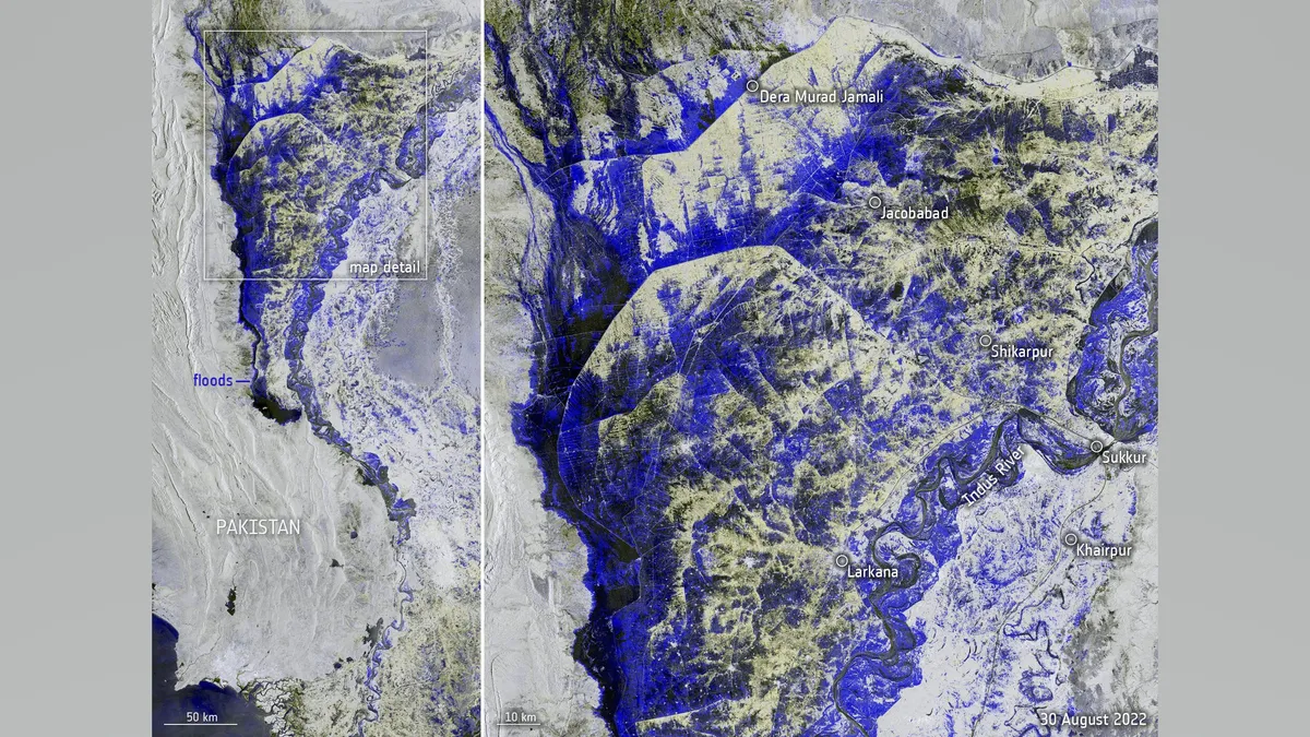
Satellite views show that a third of Pakistan is under water as a result of months of unrelenting rain. Pakistanis are suffering from the most severe repercussions of climate change despite accounting for only approximately 1% of global greenhouse gas emissions. According to the European Space Agency (ESA), which released a new satellite picture of the embattled Asian country on Thursday, heavy monsoon rains have pounded the Asian country since mid-June, reaching 10 times the usual rainfall rates for this time of year (Sept. 1)
The new image, taken on Tuesday (Aug. 30) by the Copernicus Sentinel-1 satellite, shows the extent of the destruction in stunning detail: The Indus River overflowed its banks, forming a lake more than 60 miles (100 kilometers) long and 6 miles (10 kilometers) wide; vast areas of land in the country's west, along the border with Afghanistan, were submerged; and streams of meltwater flowed down the Himalayan and Karakoram mountain ranges. According to ESA, the flood has claimed over 1,100 lives and affected 33 million of Pakistan's 220 million inhabitants. The floods were labeled as the worst in Pakistan's history by Prime Minister Shehbaz Sharif, who estimated that it would cost at least $10 billion to rebuild destroyed infrastructure.
The Pakistani calamity is not a result of chance. According to Al Jazeera, the rains were followed by a heatwave in May, which intensified the melting of mountain glaciers, producing floods and soaking the land with rainwater. Despite being a modest contributor to global greenhouse gas emissions, Pakistan, where 22% of the population lives in poverty, is experiencing the pain of climate change. And so is neighboring Afghanistan, which has been ruled by the extremist Islamist organization Taliban since last year.


0 Comments