
The eruption of Iceland's Fagradalsfjall volcano is so vibrant it can be seen from space, and satellites orbiting hundreds of miles above the ground have captured images of the eruption from orbit.
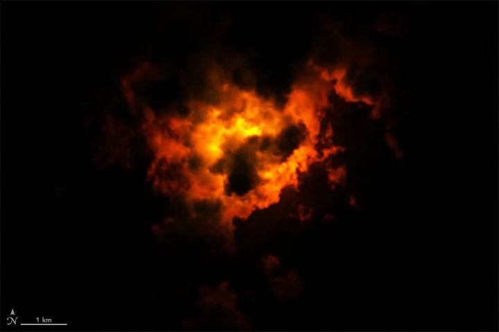
Using data from the Operational Land Imager on NASA and the U.S. Geological Survey's Landsat 8 satellite, NASA data visualizer Joshua Stevens pieced together a false-color image of the eruption. The image shows the eruption at 10:25 p.m. local time (2225 GMT) on March 22, three days after it started on March 19.
The ominous, nighttime image was made from a combination of shortwave and near-infrared data (bands 7, 6, 5), according to NASA. It shows how the lava lit up the clouds from below. Because lava is so hot, it can glow in the shortwave-infrared part of the electromagnetic spectrum.
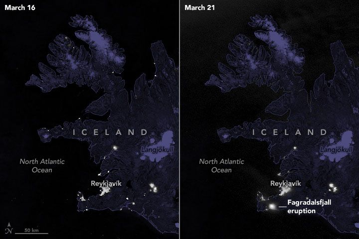
NASA said, although the image looks like a ball of fire in the sky, and the volcano can be seen more than 20 miles (30 kilometers) away in the nation's capital of Reykjavik, there's very little danger to people in the surrounding area.
In fact, people are traveling to see the eruption, rather than fleeing from it. One brave tourist even flew a drone slightly above the lava path, leading to the vent of the erupting volcano. The resulting video is breathtaking.
This eruption comes after three weeks of earthquakes in the area, with the nation recording more than 50,000. Currently, experts predict that the eruption will be a long-hauler.
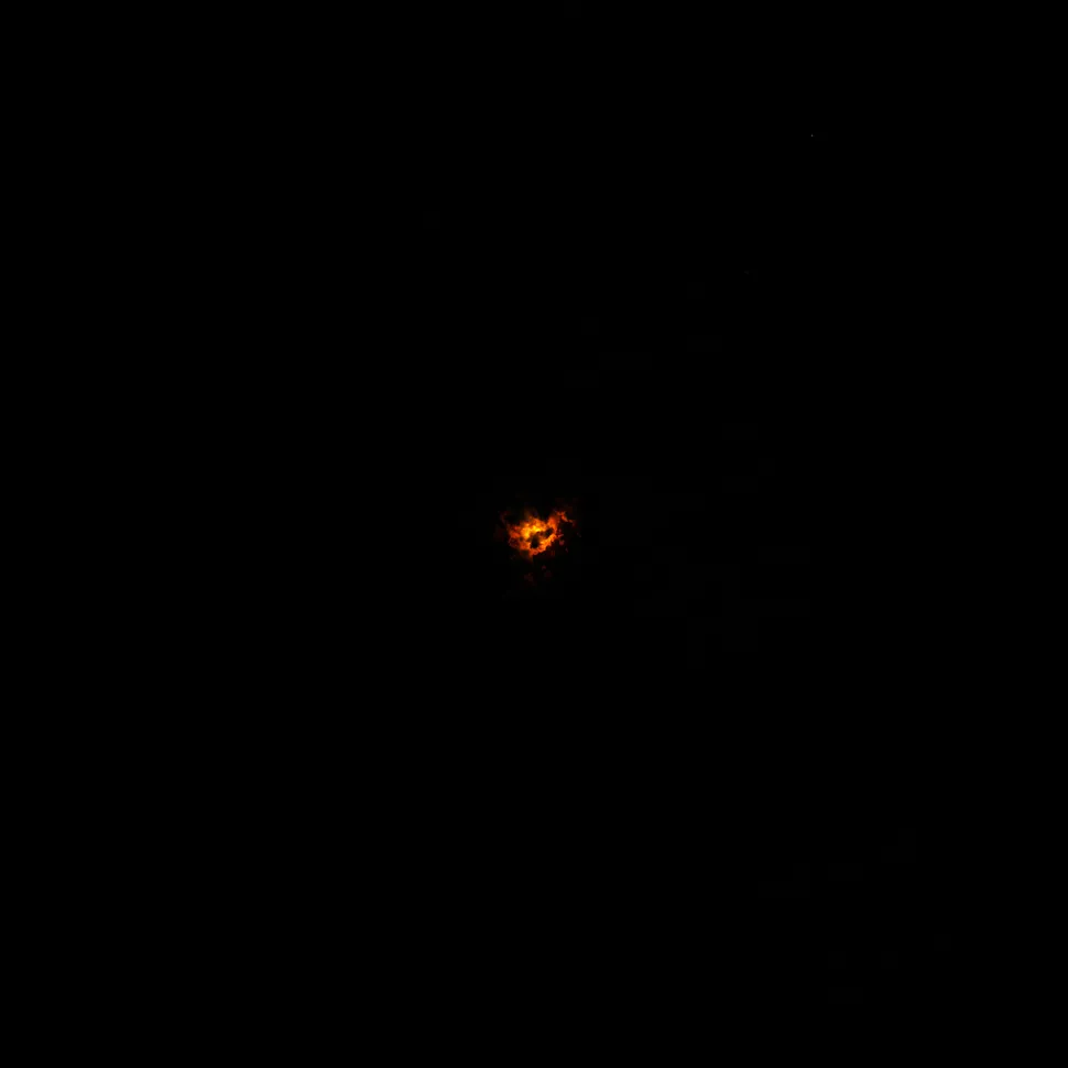
As the eruption continues, we can likely expect to see more images of the impressive lava flow, both from Earth and from satellites. In fact, Planet Labs has already posted a daytime view of the eruption on Twitter, taken from the labs SkySat satellites.
After days of ☁️ with a chance of ❄️ one of Planet’s high-resolution SkySats captured a glimpse of Iceland’s Fagradalsfjall volcano. Imagery including near-infrared light (second image) highlights the path of the molten lava. pic.twitter.com/xniab0qbdK
— Planet (@planetlabs) March 26, 2021


0 Comments